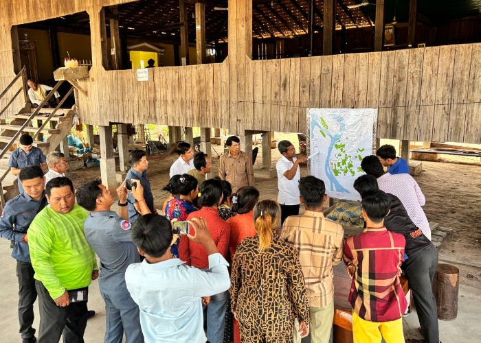
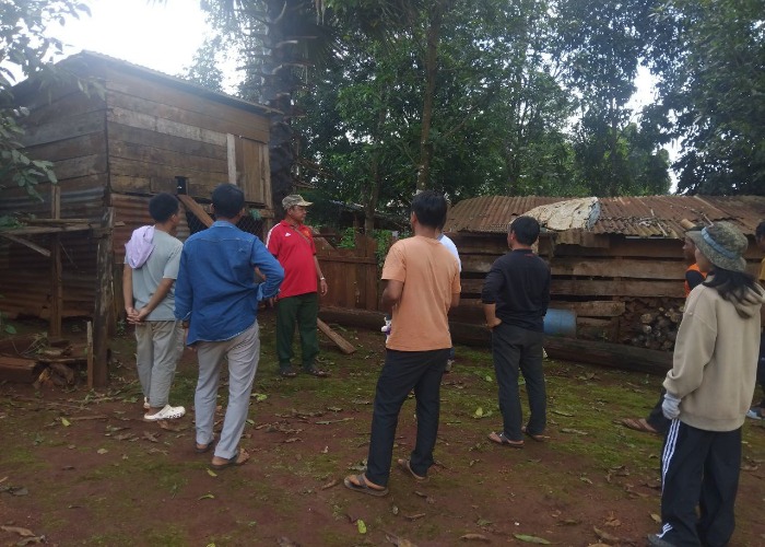
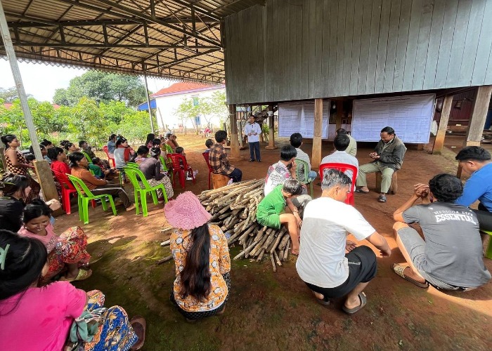
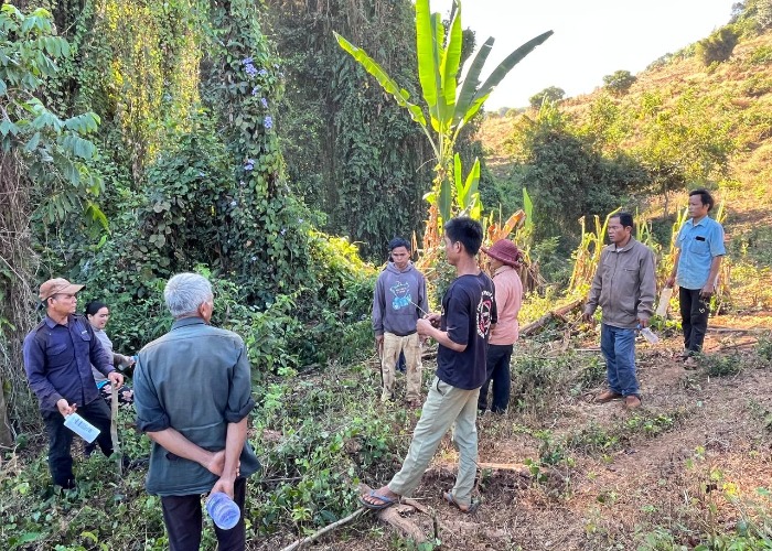
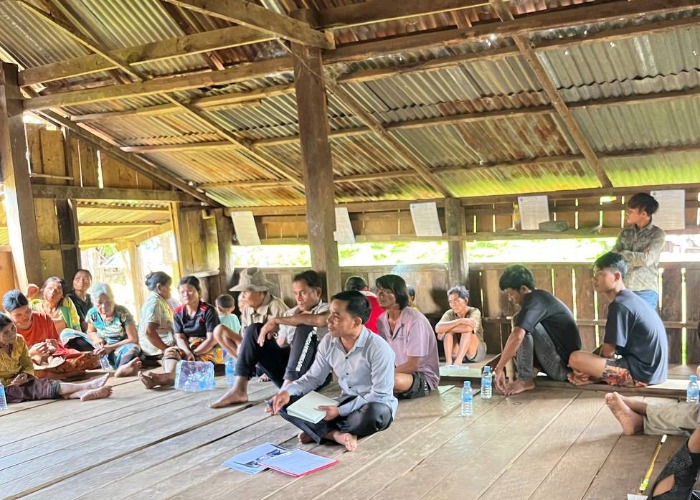
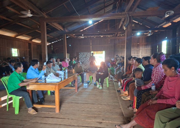
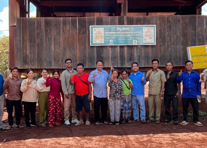
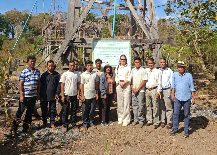
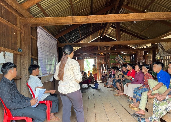
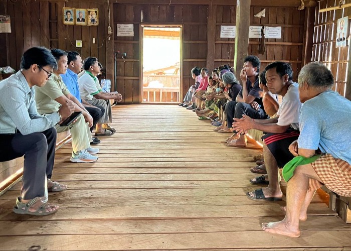
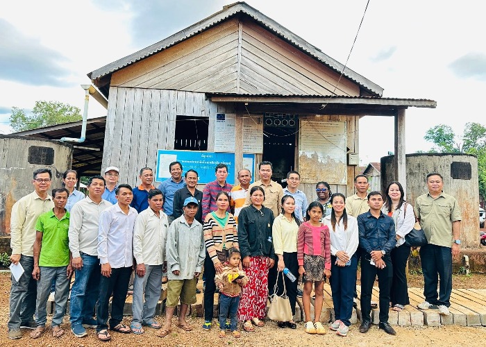
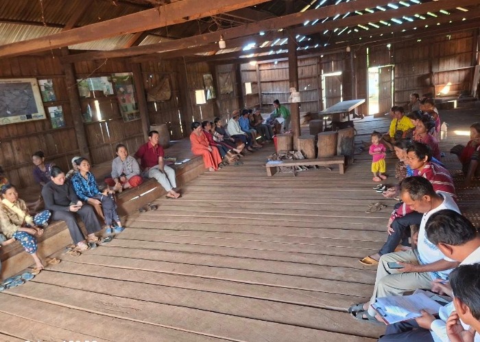
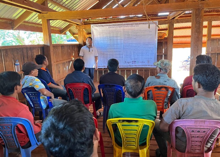
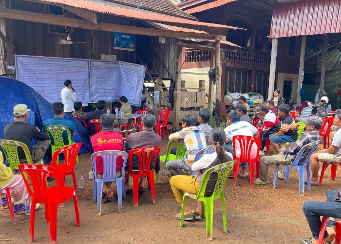
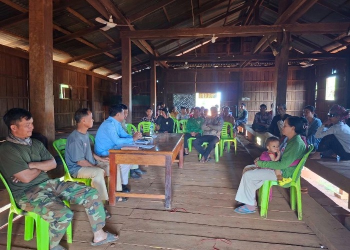
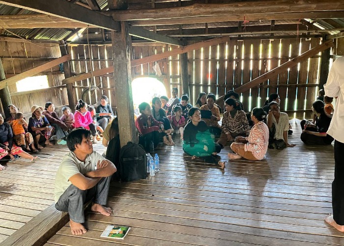
On February 24, 2026, the ICSO team participated in the public release of the land boundary map of the Kuy indigenous community in Koh Khnaer village, O’Kreang commune, O’Kreang Senchey district, Kratie province. The event was attended by relevant authorities, including the Deputy Governor of O’Kreang Senchey District, representatives of the Department of Land Management, Urban Planning, Construction and Cadastral, representatives of the Department of Water Resources, representatives of the Department of Rural Development, representatives of the Department of Environment, representatives of commune and village authorities. Approximately 30 indigenous community representatives (10 of whom were women). At the release of the land boundary map, the representatives of the Department of Land Management, Urban Planning, Construction and Cadastral explained how to view the map to the community to ensure that the community understood and recognized the land boundaries defined in the map. The posted land boundary map shows that the land is 843.8044 hectares, collectively owned by 200 families with a total of 853 Kuy Indigenous members (430 women). This land boundary map is posted in the compound of the Kuy Indigenous Community, Koh Khnaer Village for 30 days effective from February 24 to an end on March 25, 2026, for the stakeholders to inspect, if there is any disagreement on that.
The Kouy Indigenous Community hosted a Community General Ass
On October 22, 2025, the ICSO team collaborated with the loc
On January 28, 2026, the ICSO team monitored and conducted a
On September 30, 2025, ICSO team collaborated with local aut
On February 17, 2026, the ICSO team conducted a monitoring v
On 20 August 2025, the ICSO working group, in collaboration
On September 29, 2025, the ICSO organization team collaborat
On January 27, 2026, the ICSO team went to the target locati
On September 16, 2025, ICSO team collaborated with the villa
On November 19, 2025, the ICSO team collaborated with the lo
On September 9, 2025, the ICSO organization team, in collabo
On October 8, 2025, ICSO collaborated with local authorities
On the morning of August 5, 2025, the ICSO team, in collabor
On November 21, 2025, the ICSO team collaborated with the lo
From 11–13 February 2026, the ICSO team collaborated w
From February 11 to 13, 2026, the ICSO team collaborated wit
On August 15, 2025, ICSO team collaborated with local author
On October 16-17, 2025, ICSO supported the Charay indigenous
On November 28, 2025, the ICSO team organized a training cou
On October 22, 2025, the ICSO team collaborated with the loc
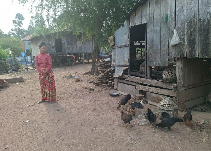
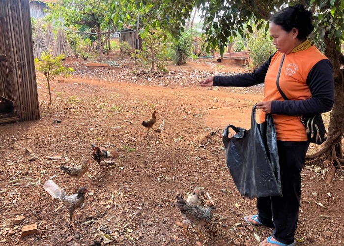
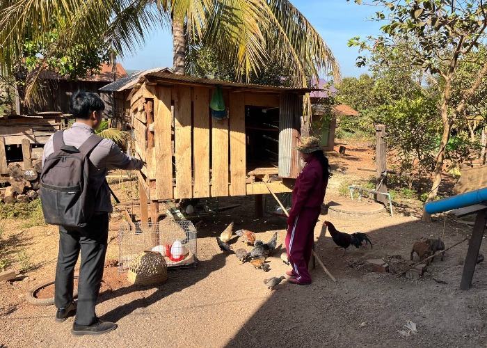
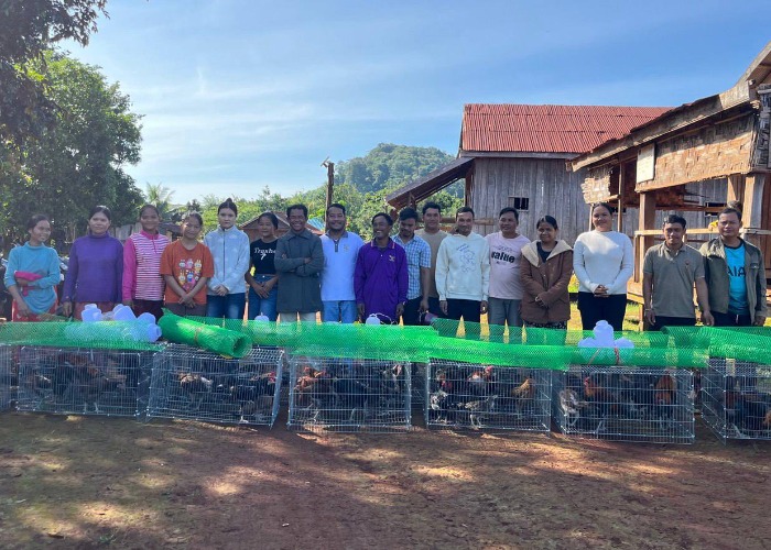
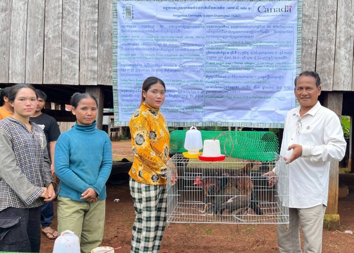
On February 10, 2026, the ICSO team distributed chicken bree
On September 10, 2025, ICSO team collaborated with the local
On October 16-17, 2025, ICSO supported the Kreung indigenous
On 16 February 2026, the ICSO team cooperated with Svay Vill
On February 3, 2026, the ICSO team conducted a project monit
On December 10, 2025, ICSO team held a meeting with the loca
On October 30, 2025, the ICSO team participated in the offic
On October 2, 2025, the ICSO team collaborated with the loca
On November 13, 2025, the ICSO team, in collaboration with t
Congratulation to Kouy Indigenous Community Leader of Koh Kh
On December 8, 2025, the ICSO team cooperated with the local
On October 20, 2025, the ICSO team collaborated with experts
On October 20 to 23, 2025, the ICSO team supported the Commu
On 16 February 2026, the ICSO team cooperation with Ka Tieng
On October 8, 2025, ICSO conducted a training session for th
On May 28, 2025, ICSO teams from Ratanakiri and Phnom Penh h
On January 12, 2026, the ICSO team collaborated with the Ka
The Representative of the Ministry of Interior (MoI) of Camb
On 29-30/04/25, ICSO representative has participated in a co
On February 19, 2026, ICSO team facilitated a visit of the C
On September 9, 2025, ICSO, in collaboration with the Depart
On 16 February 2026, the ICSO team cooperated with Lae Villa
On September 17, 2025, ICSO team collaborated with local aut
On August 19, 2025, ICSO Team in collaboration with local au
On November 21, 2025, the ICSO team collaborated with the vi
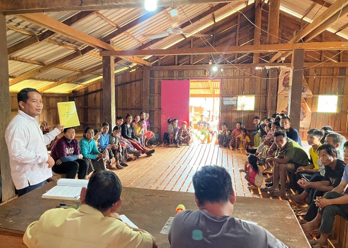
On February 23, 2026, the ICSO team conducted a refresher tr
On September 16, 2025, ICSO team collaborated with the villa
On November 21, 2025, the ICSO team collaborated with the vi
On 27 November 2025, the ICSO team conducted a training sess
On September 12, 2025, the ICSO team collaborated with the v
ICSO team has collaborated with FLO, NGO partner and local a
On August 6, 2025, ICSO team has collaborated with the local
On December 9, 2025, ICSO team met with the local authoritie
On September 8, 2025, the ICSO team, in collaboration with t
On February 6, 2026, the ICSO team collaborated with the KaT
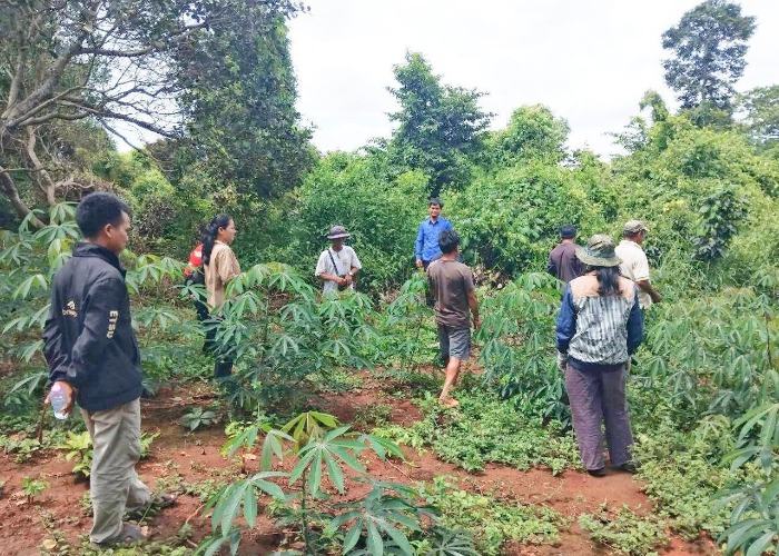
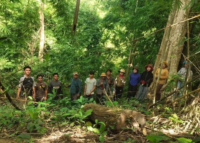
On February 25, 2026, the ICSO team conducted monitoring and
On May 21, 2025, ICSO team collaborated with technical offic
On September 11, 2025, the ICSO team collaborated with the l
On 24 July 2025, ICSO Team has facilitated Kouy Indigenous C
On October 7, 2025, the ICSO team conducted a training sessi
On February 23, 2026, the ICSO team conducted a training ses
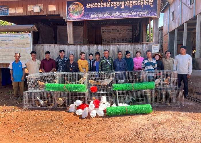
On February 25, 2026, the ICSO team conducted monitoring and
who serves as the Governance Board Secretary, is facilitated
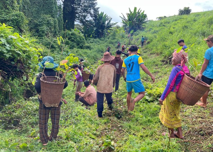
On February 20, 2026, the ICSO team monitored and provided a
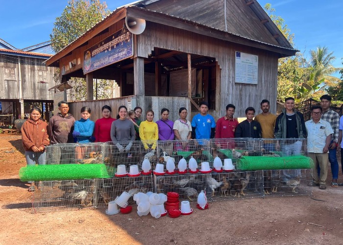
On February 4 2026, The ICSO team provided selected model fa
On 20 November 2025, it is the opportunity that ICSO team ha
On October 3, 2025, the ICSO team, in collaboration with exp
On 25 November 2025, the ICSO team, in cooperation with tech
On January 12, 2026, the ICSO team collaborated with the Ka
On January 9, 2026, the ICSO team conducted a training cours
On September 29, 2025, the ICSO organization team collaborat
On November 14, 2025, the ICSO team, in collaboration with t
On November 10, 2025, the ICSO team provided chicken breeds
On October 7, 2025, the working group of ICSO collaborated w
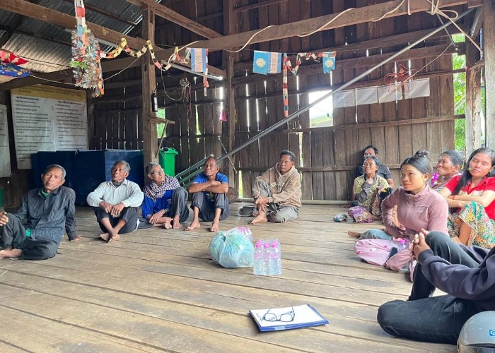
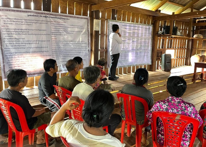
On February 17, 2026, the ICSO team conducted a meeting with
On 20 November 2025, the ICSO organization team, in collabor
On August 14, 2025, the ICSO working group, in cooperation w
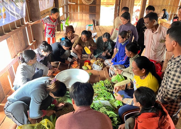
On October 9, 2025, ICSO trained the community on how to mix
On Thursday, October 2, 2025, the ICSO team, in collaboratio
On November 24, 2025, the ICSO team collaborated with expert
On February 3, 2026, the ICSO team organized a training sess
The work continued from November 12 to 14, 2025. The ICSO te
On September 19, 2025, the ICSO team has collaborated with l
On September 18, 2025, the ICSO team collaborated with the l
On May 22, 2025, ICSO team collaborated with experts from th
On October 23, 2025, the ICSO team collaborated with the loc
On October 14, 2025, the ICSO team provided breeding chicken
The ICSO Operational Management Manual (OMM) outlines execut
On November 11, 2025, the ICSO team collaborated with expert
On October 3, 2025, the ICSO project team, in collaboration
On 17 February 2026, the ICSO team met with Svay Village aut
On November 26, 2025, the ICSO team provided training to the
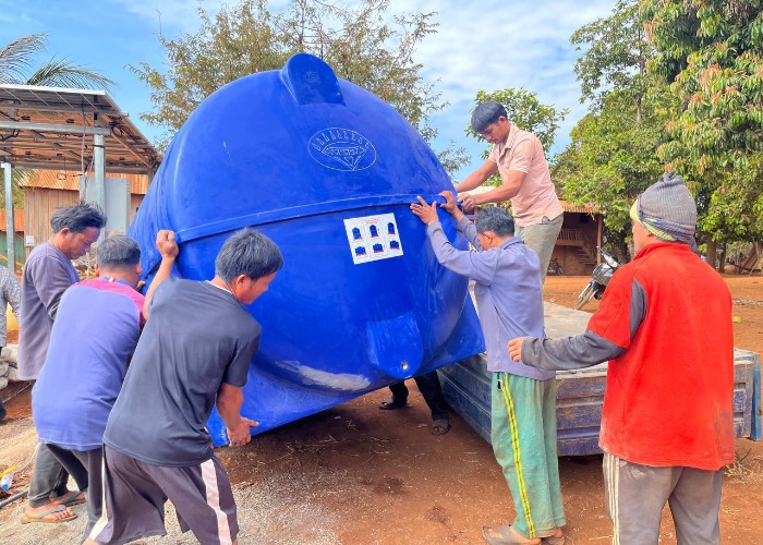
On February 22, 2026, the ICSO team delivered materials to t
On January 8, 2026, the ICSO team convened with village auth
On October 13 to 14, 2025, the ICSO supported the Prov Indig
On September 30, 2025, ICSO team collaborated with local aut